Filamora Studios › Paper printables
City Map Poster
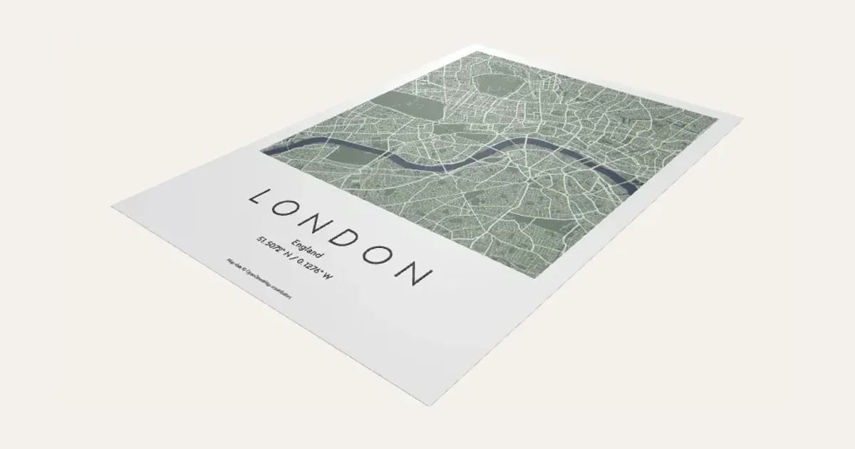
Your town or city as a poster: every street, river and park as a tall map filling the top of the page, and the name in wide-spaced capitals underneath with the country and the coordinates. Ten colour themes, or your own colours. To print and frame. UK for now.
Customise it in your browser, then download a print-ready PDF to print at home. No design skills needed.
About the City Map Poster
A city map poster of your town or city: every street, river and park from OpenStreetMap as a tall map filling the top of the page, with the name in wide-spaced capitals underneath, the country and the coordinates. Ten colour themes, from Mono and Navy to Blush and Forest, or set your own colours. To print and frame.
What you can change
- Type your own city and line under it.
- Pick the place: search for it, paste coordinates or a map link, or use where you are.
- Coordinates as: decimal and degrees, minutes, seconds.
- Roads: every road and path, roads and streets and main roads only.
- City font: 29 to choose from, from script to stencil.
- Small text font: 29 to choose from, from script to stencil.
- Print size: A4, A3, A5, 8 × 10 in, 11 × 14 in and 12 × 16 in.
- All 7 colours are yours to pick.
- Adjust latitude, longitude, map reaches and line weight, and more.
- Turn on or off: the coordinates under it, rivers, lakes and sea, parks and woods and fade the map into the page behind the name.
What you download
A PDF to print on paper or card and cut out.
Printing it
Print at 100% on matt paper or card and frame it, or use the picture download (300 or 600 dpi) for a print shop. Find the town or city (UK for now), then set how far the map reaches: about 2 km shows a city centre, 4 to 6 km a whole city. Pick a colour theme from the buttons at the top. Map data © OpenStreetMap contributors, printed small at the foot of the page.
Questions
Which places can I map?
Any town or city in the UK for now: search for it, then set how far the map reaches. About 2 km shows a city centre, 4 to 6 km a whole city.
Can I change the colours?
Pick one of the ten themes, then change any colour: the land, water, parks, main roads, streets, page and words.
How do I print it?
Print at 100% on matt paper or card and frame it, or download the picture at 300 or 600 dpi for a print shop. It comes in A5, A4, A3 and 8 × 10, 11 × 14 and 12 × 16 inches.
Can I sell what I make?
On Pro and Ultimate you can sell the prints you make, for example on Etsy or at craft fairs, for as long as your membership is active: if it ends, stop selling them. On Free and Maker, print it for yourself or give it as a gift. The PDF itself is never for sharing or selling.
More Paper printables
- Kindle Insert
- Phone Case Insert
- Tablet Case Insert
- Definition Print
- Family Tree Print
- Letter Tile Family Print
- Gift Ticket
- Scratch to Reveal Card
- Calendar Print
- Coordinates Print
- Subway Word Art
- Star Map
- Map Print
- Cocktail Print
- Nursery Animal Print
- Street Card Print
- Family Print
- Text Poster
- Birth Stats Poster
- Picture Bookmarks
- Labels & Tags
- Reading Tracker
- Reward Chart
- Name Colouring & Tracing
- Word Search
- Birth Announcement Print
- Letter from Santa
- Moon Phase Print
- Race Route Print
- Family Recipe Print
- Pet House Rules Print
- Our Story Timeline
- Song Lyric Record Print
- New Home Print
- Our First Christmas Print
- Our Year Print
- Pet Profile Print
- Fan Stats Print
- Words in a Heart Print
- New Home Key Print
- Reasons We Love You Print
- Bucket List Print
- Baby's First Year Print
- Christmas Eve Box Labels
- Personalised Wrapping Paper
- Christmas Bingo Cards
- Secret Santa Cards
- Coupon Book
- Years Together Print
- Pet Adoption Certificate
- Bottle Labels
- Christmas Activity Placemat
- New Year's Resolutions Print
- Advent Activity Calendar